Posts

Showing posts from 2014

Prezi on Community Mapping

Here is a link to a prezi that we gave on Community Mapping. https://prezi.com/pytswfb6py8w/untitled-prezi/

Sanitation

Image
A UN special envoy visited the United States in February 2011. Catarina de Albequerque made several recommendations about access to water and sanitation as a human right. The UN report has many striking paragraphs and sections; typical phrases and descriptions for the developing world, not so typical for our California home. As usual, the human right to water was the most popular theme. It went to Sacramento and in  2012 was passed as  Assembly Bill 685 guaranteeing the human right to water. That was a successful bill,inspired by Dr. Albequerque's visit and a political movement of water access folks. Despite all the energy around drinking water, there wasn't much ground gained for the  human right to sanitation. There are still many California residents who do NOT have access to functioning sanitation. The UN report recommends placing the human rights to water and sanitation equally at the center of policy formulation. As topics go, water is always more popular than san

Balloon Mapping workshop on Loma Linda Campus

Image
We had  five people participate in the first balloon mapping workshop on Loma Linda Campus. Many people asked "what are you doing?". Nobody seemed to threatened by the process. One major strength that Balloon Mapping has over Aerial Mapping with a quadcopter/RC plane is that balloon mapping is participatory. Everyone has a role in these community mapping workshops. There is a line to hold, a route to scout, photos to take or the public relations required for the many questions.  Aerial mapping with an RC powered device is less participatory as much of the technology is considered to be "hands off". The camera was set for shooting a photo every two seconds for a good 30 minutes.  We used a canon 260sx with the KAPUAV lua loaded in the CHDK software. I then used Microsoft ICE to throw a few pictures together.  Here is a stitched photo of the LLU Globe (click the photo to zoom in).  More will come later.  

Balloon Aerial Mapping BRIEF WORKSHOP

Image
From http://publiclab.org/wiki/kite-balloon-hybrid A NEW Community Mapping Approach : Balloon Mapping BRIEF WORKSHOP #1 DATE/TIME : 10/29/14 - 0800  LOCATION:  Evans Hall turnout in Loma Linda University off of Anderson 24785, Stewart St. Loma Linda, CA 92354 Meet by the Loma Linda University sign in the grass. My grey truck will be nearby. WHAT IS IT?  Balloon (and Kite) photography is a participatory technique used to acquire aerial photographs and qualitative data from participants. It is a fun outdoor activity that takes a little planning and produces a lot of images. It has been used to document contamination from the BP oil spill, neighborhood environmental health issues, urban development issues and many other topics.  The unique thing about balloon mapping is that it requires a team approach and is therefore a qualitative method. Researchers can acquire lots of relevant information from the planning and organizing phase; these facilitate conversations, expl

Balloon mapping in Peru

Image
We wanted to use a balloon to do aerial mapping rather than a drone. Before the Peru trip we assumed that a tethered weather balloon would be more sustainable than using a drone for aerial mapping  which can include a downward facing camera gimble. Mario Melgar students at Laguna Chacas with an aerial mapping weather balloon. PRE-TRIP hypotheses: My hypotheses of why a balloon would be preferable to using a quadcopter equipped with a downward facing camera: Inexpensive: helium is the largest expense at about $40 for one balloon. Less accident prone and less costly if an accident happens.  If I crash my quad-copter, the cost could be a few hundred dollars. A balloon won't crash and if something happens, the string will break and you have to go hunt for it.   Faster planning. You just need a balloon, camera and helium. The outsider excitement and alarmist perspective may vary: A community response to what we know as a "DRONE" has some fear associated with

Still room for more: Sanitation-Access Research.

Image
In the last few years there has been an upswing of infection control research within the context of US healthcare. The APIC and other groups are starting to accumulate an enviable amount of fun environmental microbiology field based studies. Scientists are ev aluating contamination and health risk of curtains, hands, linens, gowns, tap water and anything else that you can find in a US hospital. My favorite are the copper hand washing sinks.  Those are deluxe! The biggest source of global fecal contamination still appears to be largely unstudied. A recent editorial in Lancet Global Health discusses this. Stephen Luby states that we still do not have enough data to generate sufficient evidence about the relationship between sanitation and health. He says that this is true because of the wide variety of pathogens, climate, environments, cultures and individual behaviors.  The Luby PDF is here .  More research is certainly complicated but also necessary. I find this promising.

A green grocery bag ban?

Image
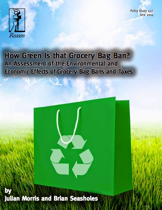
Here is a report  that summarizes  the reusable grocery bag ban trend that is hitting the US for the past 4 years. The article is written by the reason foundation , a libertarian institute in California. The article summarizes many points developed by a  lifecycle assessment on plastic bags , a report developed by the UK's environment agency. That lifecycle assessment has many scientifically valid studies that the average grocery shopper never encounters. The Reason Foundation's report summarizes many of the findings.   Here is a useful table that details most of the bags available for users.  If I had to choose, I would use the cotton bags simply because they are washable, bleach-able and easy to disinfect.  All the others don't hold up well in the Washing machine. There is fabric technology that integrates disinfectants for infection control scenarios. That would also be an interesting choice. 

My IRIS crash in Peru

Image
So I had a crash on my 3dr IRIS in Peru and the details are here. Here are some of the photos from the timelapse series. Everything going normal and the IRIS is hovering Uh oh..loiter doesn't work, I'll try altitude hold...  Oh no, those don't work..I'll try to get it back in stabilize...  Maybe RTL...nope...I'll try fly mission...maybe it will go back to California....Stabilize isn't working and it has now started on its fly away... Still no response... Click on the picture below you and you can see me starting to run in an attempt to grab the up-and-coming wreckage before someone else does. It is not easy to run/walk through a sewage wetland at 12,500 feet. Add caption LUCK #1 - Thankfully it crashed into a bush in a little lake side park. The Mobius camera was in good condition. LUCK #2 - A nice man saw it and stood next to it for a while and then handed it to me when he saw me running over.

Update on Air Sensors

Image
In a previous blog post , I discussed some ideas on open hardware air sensor designs that could work well for the Environmental Justice community in the Eastern Coachella Valley (ECV). After some months of tinkering, talking and planning,  I realize that that the technology development is probably only about 30% of the innovation required for this type of air monitoring citizen project. I'll approach this from the end result and talk about goals and objectives first. A reasonable goal would include the end health outcome while also hypothesizing the method for how that objective will be achieved. Here are some examples from similar star grants: By improving indoor air quality  (IAQ) and reducing environmental asthma triggers this study intends to reduce  asthma symptoms related to tribal home-&-school childhood exposures.  Some don't list a clear goal on the project description page but have hypothesis and an approach such as this one on water and this one on toxico

Dust Devils

Image
In Ethiopia the Oromo of Gimbie say that the Devil is in the middle of a dust devil and will possess you if it passes over you. There are a few more myths of dust devils here on the wikipedia page . Dust Devils are one of the top ten reasons why I love the desert. These mini-tornadoes are spooky, very common, yet not quite acknowledged in modern society. Freeway drivers don't notice them and weather stations don't report them. How can we not acknowledge a 500 foot tall genie that appears in the desert? They are a striking feature of the American desert that increase in frequency as human development progresses. I see them often during drought conditions, dry agricultural fields, or development projects that have gone bankrupt. My friend Jaime Lopez was driving around the eastern Coachella city limits and came across this one. That brave tractor driver was going where no tractor driver has gone before...

Ideas for Laguna Chacas lake water monitoring

We are headed to Laguna Chacas to implement a lake water quality assessment. Here are some links to the ideas that Javier has suggested. Water Quality A very good low cost fecal bacteria indicator: The H2S bacteria test Riffle sampler for aquatic macroinvertebrates. Something similar to the Hester-Dendy sampler Aerial Mapping  Kite or Balloon mapping: http://www.publiclab.org/wiki/balloon-mapping The biggest expense is helium. You can make balloons from emergency mylar sleeping bags. We could map sewage outflows and algal blooms Using RC planes or quadcopters to map algal blooms https://www.youtube.com/watch?v=Hu28ltyBxro  Its more expensive than the Balloon mapping

Citizen Science: UAS

Image
The citizen science trend is growing as groups are able to now use inexpensive sensors such as those listed on the SEEED wiki  (China) or the sparkfun website (USA) or many others.  These are all plug-n-play sensors that anyone can spend a weekend setting up and monitoring their outdoor environment. One of my citizen science goals is to use Unmanned Aerial Surveillance for environmental monitoring. This can be used for Environmental justice, or for documenting natural phenomena.  There was a recent use of a drone to monitor a meat packing industry's waste to a river. A benefit of UAS (drone) use is that they are not allowed to be used for commercial uses. That means that industry can't use them to collect data on private citizens. Drone operators are forbidden by the FAA to operate them for a profit. The converse of this is that citizens can use them to monitor industry. The UAS are great for environmental justice. A couple of groups using them for environmental purposes ar